


Constraining rates of deformation in active orogens across timescales (Funded, NSF-EAR2123412)
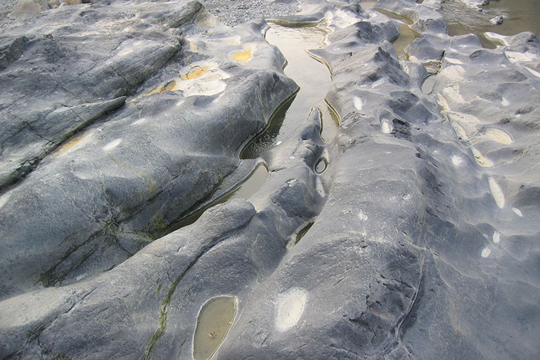
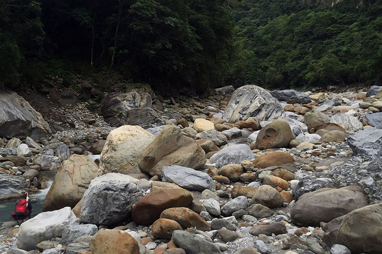
Image Caption: Taken at the pass near Taroko gorge. Collaboration with Prof. Kaj M. Johnson (Indiana University, Bloomington) and Prof. Nadine McQuarrie (University of Pittsburgh)
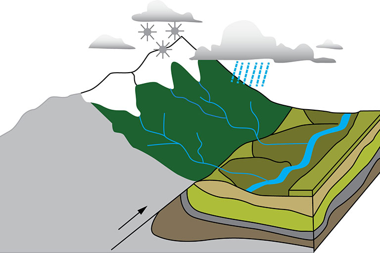
Active orogenic landscapes undergo deformation under the influences of tectonics, climate and other forcings. However, these processes act on the landscape across markedly different timescales. This has led to discrepancies in the measurements of deformation rates across these timescales. In this project, the collaborating groups are attempting to constrain rates of deformation in Taiwan orogen and how they have evolved across three different timescales- short-term (geodetic vertical rates), intermediate (bedrock incision) and long-term (thermochronology). We seek to build a comprehensive model of river erosion in Taiwan by integrating local bedrock incision, upstream sediment supply, channel morphology, bedload grain size, and discharge data. This will provide an important link between modern/recent deformation from geodetic methods (Johnson group) with long-term patterns of exhumation and topographic development determined through integrating thermochronometric data with cross-section reconstructions (McQuarrie group).

Cascading hazards
Extreme events such as earthquakes, volcanic eruptions, tropical cyclones, and tornadoes are rare, but their geomorphic consequences can be dramatic and long-lived. These events often trigger cascading hazards, where one process—like an earthquake or major storm—sets the stage for others such as landslides, debris flows, or flooding. My work has helped define the research frontier for cascading hazards, highlighting how geomorphology can uniquely address fundamental questions about how Earth systems interact to shape the frequency, magnitude, and persistence of hazardous processes (Yanites et al., 2025).
Case studies from Taiwan illustrate the long tail of these hazards. Typhoon Morakot (2009) delivered over three meters of rainfall in four days, generating more than 20,000 landslides and depositing massive volumes of sediment in river valleys. Our measurements show that in some regions sediment has already been evacuated, while in others it will persist for decades to a century, reshaping river systems long after the storm (DeLisle et al., 2022). Building on this, Brooke Santos modeled how river aggradation altered flood hazards, finding that inundation increased by up to 44% in certain valleys. Ongoing work extends these efforts to track sediment cascades following the 2024 Hualien earthquake and subsequent typhoons in Taiwan, as well as post-hurricane landslides in the southern Appalachians. Together, these studies reveal how extreme events propagate hazards through landscapes, leaving persistent geomorphic and societal legacies.

Life and landscapes
Our group explores how life and landscapes shape one another through time, using innovative models that evolve topography in response to geologic processes such as uplift and erosion. These tools let us probe how ecosystems adapt to shifting landscapes and provide a new way to study Earth–life interactions. A central challenge we address is that fossils are preserved in lowland basins, while modern biodiversity peaks in mountains; by linking upland and lowland diversity, our work reveals how the fossil record captures life’s true history. Together, this coupled landscape–ecosystem framework reproduces broad patterns of biodiversity and mountain development, opening new frontiers for understanding the coevolution of Earth’s surface and its living systems.
Key paper: Marder, E., Smiley, T. M., Yanites, B. J., and Kravitz, K. (2025). Direct effects of mountain uplift and topography on biodiversity. Science, 387(6740), 1287-1291.

Exploring the dynamics of bedrock meandering rivers (Funded, NSF-EAR2120211)
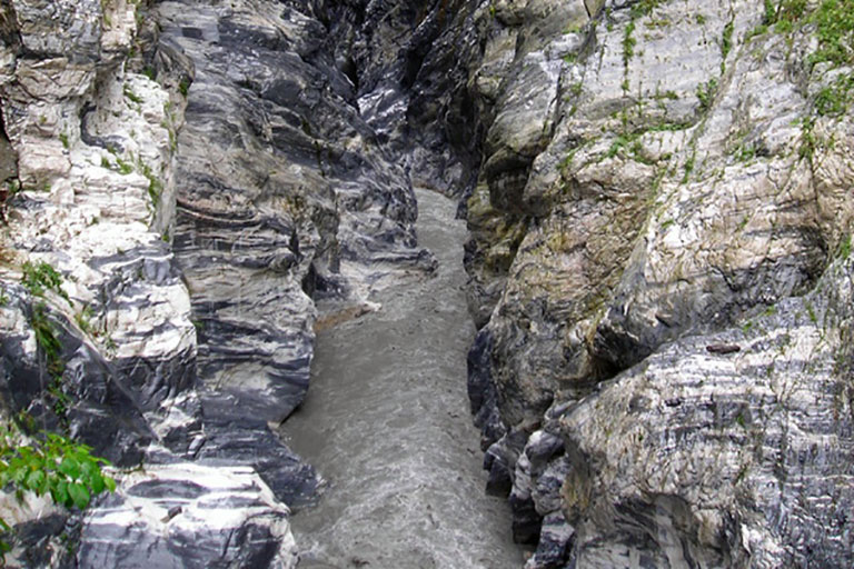
Image Caption: Siouguluan River, Hualien, Taiwan
What makes some rivers cut deep into rock while others weave across broad valleys? Bedrock channels, unlike their alluvial counterparts, must bend and migrate while carving through resistant terrain. Their shape reflects a delicate balance between downward incision and sideways erosion, with sediment cover acting as both a shield and a tool. Studying these processes reveals how landscapes evolve and highlights the feedbacks that shape river landscapes in tectonically active regions.

Tree throw
Image caption: Path of uprooted trees due to an EF3 tornado in McCormick’s Creek State Park
Our research also examines how biological activity drives geomorphic change, focusing on the role of vegetation in shaping landscapes. Classic examples include Darwin’s work on earthworms and erosion, and the process of “tree throw,” where uprooted trees displace large amounts of soil and sediment. Using high-resolution lidar, we can now map tree throw across forested terrain, revealing strong patterns tied to wind direction and hillslope orientation. Current projects extend this work to quantify tornado impacts in southern Indiana, develop machine-learning tools to map tree throw across North America, and assess how uprooting alters soil properties—efforts that highlight the powerful influence of life in sculpting landscapes.
Key Papers:
Doane, T.H., Edmonds, D., Yanites, B.J., and Lewis, Q., 2021, Topographic Roughness on Forested Hillslopes: A Theoretical Approach for Quantifying Hillslope Sediment Flux From Tree Throw: Geophysical Research Letters, v. 48, p. e2021GL094987, doi:10.1029/2021GL094987.
Doane, T.H., Yanites, B.J., Edmonds, D.A., and Novick, K.A., 2023, Hillslope roughness reveals forest sensitivity to extreme winds: Proceedings of the National Academy of Sciences, v. 120, p. e2212105120, doi:10.1073/pnas.2212105120.

Impact of grain size distribution on bedrock erosion and channel morphology
Sediment dynamics are often absent in the commonly used approaches of quantifying the spatio-temporal evolution of river systems and their morphology. In this project, we seek to understand how the distribution of grain size impacts the topographic expression of tectonic and climatic processes. We make use of the python-based 1-D model, OTTERPy, to simulate evolution of river profiles over time, integrating suites of grain size distributions, uniform and stochastic water discharge, and different magnitudes of tectonic perturbations.
Co-evolution of climate and landscapes (Funded, NSF).
Collaboration with Prof. Chris Poulsen, University of Michigan.
Topography in mountainous regions is a product of the erosion and export of material across the landscape. The frequency and magnitude of erosion events occurring in these regions is controlled by the local climate. The topography of the mountain ranges, in turn, influences the climate. This suggests a coupling between atmospheric and geomorphic processes in regions of active mountain building. Observational studies of climate-topography-erosion relationships, however, have been equivocal. One potential reason for this disparity in observational results is that the modern climate, for which most studies depend on, is a poor representation of the integrated climate history over landscape. Over the timescale of mountain building, climate can vary due to orbital variations, greenhouse gas concentrations, and the development of topography. This work will develop a coupled climate-landscape evolution model framework to quantitatively investigate interactions between climate, topography, and erosion on geologic timescales. The co-evolution of climate and landscapes will be modeled at different latitudes (e.g. tropical, sub-tropical, and mid-latitude) and for different orbital configurations in order to increase our understanding of the spatial and temporal variability inherent in the coupled climate and landscape systems. This work will complement previous and ongoing empirical studies exploring the interaction of climate and topography.
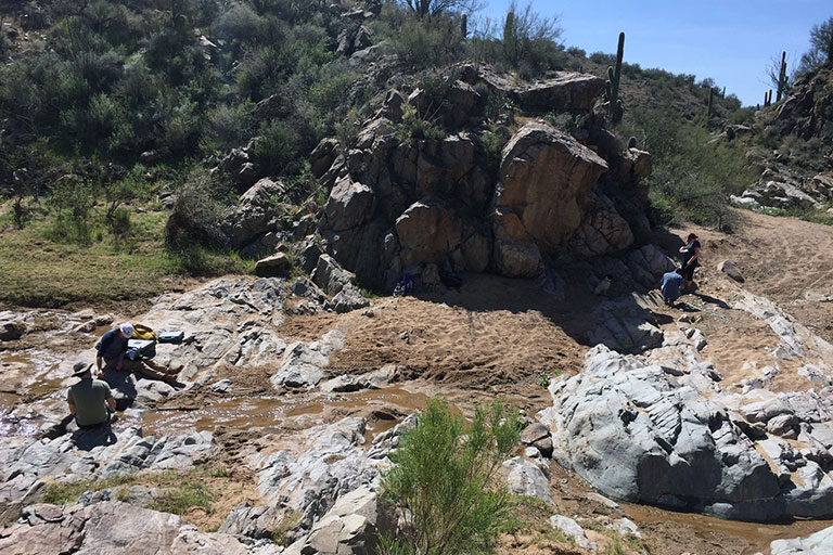
Rock-type, bedrock erosion processes, and channel morphology in central Arizona. (Funded DoD-ARO).
This project will quantify how differences in rock strength result in changes in channel morphology of bedrock streams, providing a potential method to remotely map rock strength from observations of channel morphology. The field area is in a natural experiment in central Arizona where streams flow over a wide range of rock types and exhibit significant changes in morphology. The project will provide insight into why and how rock strength influences bedrock erosion processes and morphology at the reach scale. Measurements of channel morphology and characteristics will be compared to quantitative estimates of rock strength. Additionally, a series of controlled laboratory experiments using a flume in collaboration with Elowyn Yager and a rock fatigue apparatus in collaboration with S.J. Jung will quantify the susceptibility of the different rock types to abrasion and damage accumulation. The results of the proposed work will result in quantitative relationships between channel morphology and rock strength. Moreover, because of the focus on understanding why and how rock strength influences reach scale channel morphology, we will develop a quantitative framework for predicting rock strength from channel morphology in locations beyond our field site.
Lithology and landscape evolution: central Idaho (Funding: Preliminary work by UofI Seed Grant; NSF-Pending).
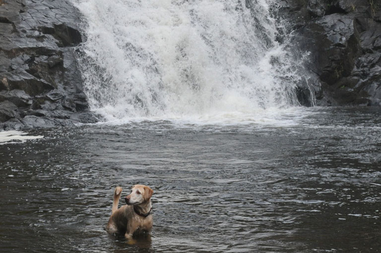
Photo above: transient river in Idaho. Hyperactive Laborador for scale.
In addition to local controls on channel morphology, as mentioned above in the central Arizona project, lithology can influence the rate of landscape transience over longer, geologic time and space scales. In this project, we seek to understand how lithology influences landscape evolution and transience over geologic timescales. Preliminary work suggests that the Salmon River incised a deep (~1.2 km) gorge starting at about 9 million years ago. This gorge cuts through a number of different rock types, sending off waves of transients into the surrounding landscapes. The rate at which these knickzones propagate is being controlled by the local lithology. We are quantifying the rate of knickpoint propagation and the rock mass properties that control the erosional resistance. The results will inform numerical models of landscape evolution on typical ranges of erodibility values and what rock mass properties dictate the resistance.
Various projects: pending and funded by NSF-tectonics and gld)
Rivers in mountainous landscapes are influenced by two fundamental properties of its environment: (1) the rate of vertical baselevel fall, which is driven by rock-uplift and (2) the supply of coarse, bedload sediment from upstream hillslope processes. Our work uses natural experiments in diverse places such as tropical Taiwan and southern Peru to quantify how bedrock rivers evolve. We estimate rates of erosion using cosmogenic nuclides and optically stimulated luminescence. Field-work and GIS analysis are used to measure channel width and slope. These data provide great insights into the interaction between sediment supply and the morphology of the river. We use these data to inspire and inform new numerical models that quantify river evolution over a range of timescales and provide insight into the tectonic environments in which they evolve.
Advancing the utility of geochronology techniques (specifically cosmogenic nuclides and thermochronology)
How do landslides and sediment transport influence basin wide erosion rates estimated by cosmogenic nuclides? Specifically, how do pulses of landslide activity, from events such as earthquakes or large, rare storm events imprint the cosmogenic nuclide inventory, and how long do these impacts last? Answering this requires estimates of landslide sizes and information on the transport capacity of the fluvial system.
Another question our group purses related to geochronology techniques is: how do landscape dynamics influence thermochronology age distributions?
Glacial landscape evolution
How can we quantify glacial erosion over long time scales?
What impact do glaciers have on both the local topography and topography downstream of maximum glaciations?